

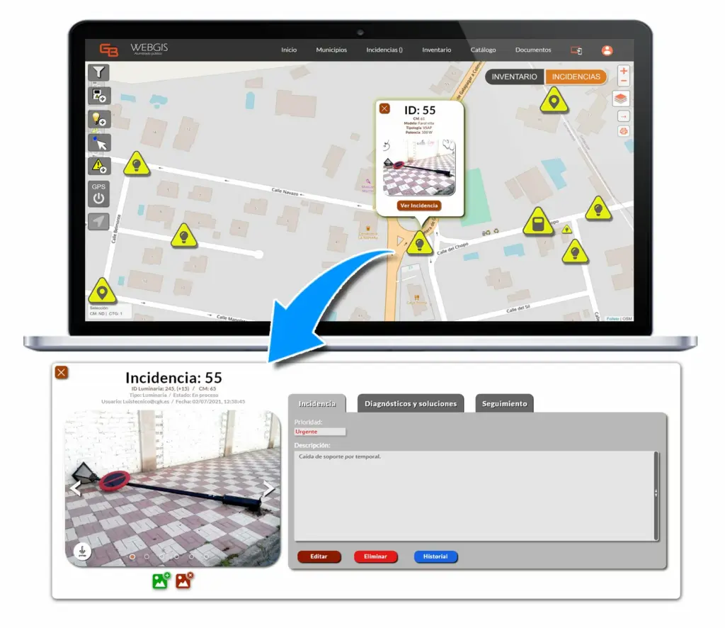
At a glance
Photo + location
Every report arrives with a photo, a note and its exact position.
By urgency
The council sees incidents in a list ordered by urgency.
Closed loop
The resident is notified when the issue is resolved.
The project
The challenge
Councils need a simple way for residents to report issues in public spaces and a clear way to prioritise and follow them through to resolution.
What we did
- ReportA resident takes a photo of the issue with the app, adds a note and the location is captured automatically.
- PrioritiseThe council manager receives the report, logs it and places it in a list ordered by urgency.
- AssignThe person responsible for fixing it receives a notification to get to work.
- Close the loopOnce resolved, the incident is closed and the resident is notified.
Technology
Capabilities
- Photo capture
- Geolocation (WebGIS)
- Notifications
Stack
- TypeScript, Angular, Laravel, Ionic, PostgreSQL, AWS.
Results
Every report follows the same path, from the resident’s photo to the notification that it has been fixed.
More case studies

Want to connect citizens and services better? Let’s talk.
Tell us what you need to build, modernise or evolve. We’ll come back with a clear next step.