

At a glance
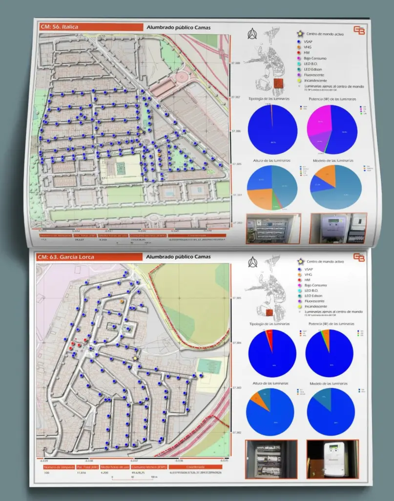
30+ municipalities
Lighting information already stored on the platform.
Spatial queries
Spatial calculations run at database level for faster access.
Cloud hosted
Data stored in a PostgreSQL instance on AWS RDS.
The project
The challenge
Public lighting inventories involve thousands of geolocated assets that municipalities need to know in detail, especially when preparing public tenders.
The consultancy needed a platform to capture that spatial information and make it fast to query.
What we did
- Spatial data modelPostgreSQL with PostGIS, so spatial calculations run directly in the database and access stays fast.
- Cloud infrastructureData hosted in a relational database instance on Amazon Web Services (RDS).
- Secure APIA REST API built in PHP with Laravel, with JWT authentication.
- Single Page ApplicationAn Angular front end, responsive for desktop and smaller screens.
Technology
Frontend
- Angular (SPA)
Backend
- PHP
- Laravel REST API
Database
- PostgreSQL
- PostGIS (spatial calculations)
Infrastructure
- AWS RDS
Security
- JWT authentication
Stack
- TypeScript, Angular, Laravel, Ionic, PostgreSQL, AWS.
Results
The platform already holds lighting information for more than 30 municipalities and supports the information used in public tenders.
More case studies

Managing assets across a whole territory? Let’s talk.
Tell us what you need to build, modernise or evolve. We’ll come back with a clear next step.